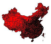

CITAS data sets include vectorized base maps of China, georeferenced socioeconomic data, bibliographic resources and utilities for coding data of administrative units. Current (January 1997) offerings emphasize county-level data and base maps for the period 1982-1990. These datasets provide a basic framework for the future extension of data both forward and backward in time. Although vectorized administrative boundary data are listed separately, each county-level dataset come bundled with a corresponding boundary file. Depending on the dataset, data are provided in ARC/INFO interchange format, SPSS, or ASCII.
| Last modified on 12 May, 1997 | Return to CITAS Homepage |